Road Scholar Trip to Panama, Nov. 11 – 17, 2018 Part 5

Thursday, Nov. 16 — We’ve traveled on planes, taxis, buses, and boat.  Today we get to add the train.

But before that we took a bus tour of the Colon area, and then headed to the Agua Clara locks.  These are the new locks that run parallel to the Gatun locks for the larger ships.

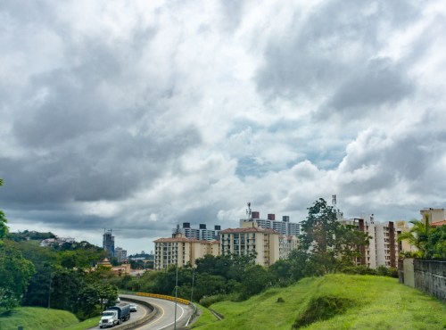
Rey told us a lot about the Colon area, as he lives here, and has most of his life.  During the period of US control of the Canal, he worked for the US, and lived on the base near our hotel.  We were given the tour on the bus, which also kept us out of the rain.  As part of the transfer to Panamanian control at the end of 1999, the bases were turned over to the Panama Canal Agency.  Much of the housing was sold to private ownership, and while the basic structures are all still quite similar to the eye, many have been improved and maintained.
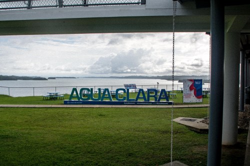
2018-11-16 12.17.11-1217.111618Our next stop is the Agua Clara locks complex, opened in 2016.  In 2007, the Panama Canal Authority was authorized by popular vote to bring the aging Panama Canal up to a higher capacity.  The vote authorized the building of the wider canal lock structures to allow ships that exceed the old Panamax size vessels into the Gatun Lake and to deepen and widen the lake channels so more traffic could flow more easily.
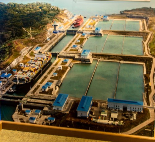
2018-11-14 13.36.54-2-1336.111418Agua Clara locks on the Caribbean side provide this extra access.  This aerial view of the locks shows clearly one of the obvious improvements over the older locks.  Each lock bay empties its water into three reservoirs, which then are used to fill the bay back up when appropriate.  The older locks on this end get water from Gatun Lake and dump it into Caribbean as they were designed back in the days long before global warming.  The new design diminishes the water necessary to operate the locks.  As with the older locks, there are no pumps, the water is moved strictly with gravity flow from place to place.
2018-11-16 11.09.04-2-2-1109.111618

2018-11-16 10.59.44-Pano-1059.111618


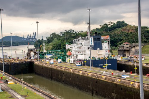
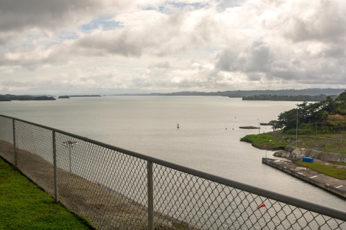
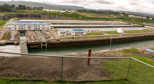
The picture above shows the Gatun Lake side of Agua Clara, coming up to the first gate.  Note in the lower picture that the gates are car-capable-road width, and are pushed across the lock bay using hydraulic pressure rather than the electric cable systems used by the smaller gates in the older locks.

2018-11-16 11.07.49-2-1107.111618

Above you see the lock bays emptying into the Caribbean, each bay slightly lower as your vision moves from left to right.

2018-11-16 11.07.42-2-1107.111618

Here can be seen a number of ships that have either just completed the Canal crossing or are waiting for the next opportunity to head for the Pacific side.

2018-11-16 12.25.52-1225.111618After looking around awhile, we headed back to the bus.  When we got there, we discovered that there is a family of howler monkeys in the trees behind where the bus is parked.
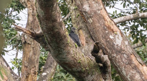
2018-11-16 12.28.37-1228.111618.jpgIn the trees could also be seen this vulture, well camouflaged.
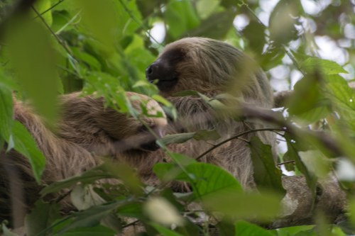
2018-11-16 13.02.40-1302.111618

As we drive out toward our next stop, the driver (whose keen eyes provided us the more unique animal sights we saw along the way) caught sight of this sloth and her baby resting themselves.
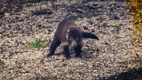
2018-11-16 12.37.08-2-1237.111618While we are on the animals we saw from the bus, here’s a Coatimundi that was kind enough to pose for pictures.  I’m told this animal is related to the raccoon that we know and periodically see in Michigan.
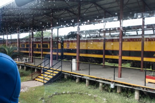
2018-11-16 13.18.47-1318.111618Next up is our train ride back across the isthmus to Panama City.  I want to compliment our tour guides for their excellent timing on this trip.  Even though we were visiting at the height of the rainy season, we almost never were out in the rain.  As can be seen in many of the pictures, there were often huge cloud formations above us, but to our comfort, when we were outside (like on the boat trip, or walking around old town Panama City), the rain held off.  This comes up now because our train ride back to Panama City finds us happily sitting in the domed car while the rain pelts down.

As with most train rides I’ve been on, this one opens with a view of the not-so-impressive parts of Colon.
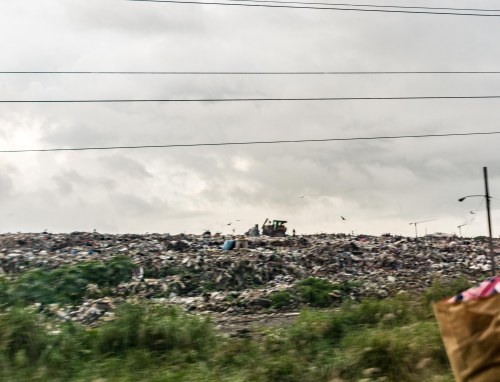
2018-11-16 14.18.11-1418.111618This one is in some senses worse than usual, as we are treated to a view of the garbage dump on our way out of Colon.

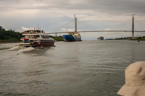
Most of the trip (total time one and a half hours, compared to the nine hours on the Islamorada), gives us good views of Gatun Lake.

2018-11-16 14.29.47-1429.111618

2018-11-16 14.31.13-1431.111618The clouds break up as we head south (yes, the Canal runs basically north-south as Panama itself can be seen on a map to run basically east-west).

2018-11-16 14.44.31-1444.111618The sun never really comes out from behind the clouds, although we do get some color from the sunset.

When we get to the station on the Panama City side, we are met by our favorite bus and its expert driver.  He uses his considerable skill to take us to our hotel for the night in downtown Panama City.
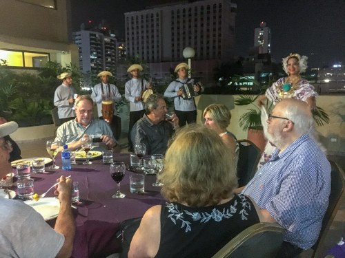
IMG_1835-2042.111618We have a bit of time to settle in, and then its out onto the terrace looking out on the buildings near by to have our dinner.  It is actually one of the best dinners we have had, and then when we are done eating, Juan Carlos has a surprise for us.  For our entertainment, a group of dancers and musicians perform for us native Panamanian dances in spectacular costumes they have made themselves.
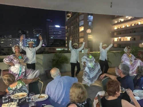
IMG_1858-2049.111618The men in the group wear hats that don’t look like what is considered a Panama hat.  The Panama hat, which is sold by every souvenir store we walked by, has a flat brim all the way around.  The hats these men wear are bent back front and back to be parallel to the rise of the part that fits over the head.  These hats are considered authentic Panamanian hats.  The souvenir Panama hats are modeled after a hat worn by President Teddy Roosevelt when he visited Panama during the building process.  This visit, by the way, was the first foreign visit by a sitting president.
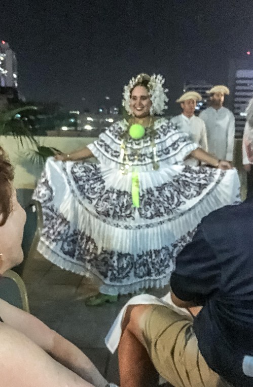
IMG_1865-2055.111618The ladies costumes are quite intricate, as shown by the picture.  These are traditionally made by the dancer herself.

The dancers went through several traditional dances, and then invited a few of the group to join them for the final dance.
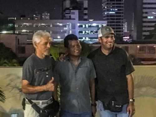
IMG_1914-2110.111618After the dancing was completed, Rey, Gabe, and Juan Carlos (l to r) were thanked by all of us for the wonderful job they did throughout the program.

Tomorrow, we go back to the airport for our return to Palm Springs.  The return trip turned out to be a lot longer than it should have been, and we missed our plane from Miami to Palm Springs.  We were rebooked on the next flight to Palm Springs, but instead of a comfortable trip on a 777, we had to settle for an uncomfortable one on a 737.  Oh, well, the visit was fun, and quite a very well done tour!


Leave a comment

Filed under Blog

Road Scholar Trip to Panama, Nov. 11 – 17, 2018 Part 4

Thursday, Nov. 15, 2018 — A leisurely trip through the Panama Canal on the good ship Islamorada.

2018-11-13 09.50.12-0950.111318The Islamorada now takes tourists through the Panama Canal, but it has quite a history.  It was built in 1912, and purchased by Al Capone in 1919.  He used it as a “rum-runner”, bringing then-illegal booze to the US from the Caribbean.  It was eventually confiscated by the US government, and served as a mine-sweeper during WW II.

So we are off.  Our journey begins in familiar territory, going down the channel we overlooked in our hotel room, now following the course of the large ships we have seen.  On our right, beyond the pelicans, is the Panama City skyline.

Coming up to us is a small boat which will deliver our pilot to us.

2018-11-15 04.52.38-0452.111518He will guide us through the Canal, as he and fellow pilots do for all the ships in the Canal.

We go under the Bridge of the Americas.  Off to the right, we notice that there is enough traffic on the Canal to make billboards a creditable source of advertising.

2018-11-15 05.14.48-0514.111518Beyond the bridge, there are ships being loaded with containers.  This port area is a large storage and redistribution yard where containers can be left off, and others going to the ports where a ship is heading added on.  These large ships are thus able to better maximize the value of their trips.

Low and behold, we are headed toward the first lock!  Come to find out we have been given permission to enter the gate, and proceed without any other ships in the lock with us — a very rare opportunity.

Very soon we are in the lock bay, with a rope tying us to the side to keep us from drifting too much.  The rear gate is closed, but for some reason it takes awhile for the water to start to lift us up.  The birds watch for fish.

Once the water has gotten us to the right level, the gate in front of us opens, and into the next bay we go.

That bay brings us up to the level of Miraflores Lake for our brief trip across to the last step up at the Pedro Miguel Locks.

At Pedro Miguel Locks, we will be put into a bay with a tug boat and a large tanker.

We are tied to the tug boat, and come extremely close to the back end of the tanker.

The bay fills from the bottom through several ports that are opened together to bring the boats up evenly without much motion front to back or side to side.

2018-11-15 07.06.50-0706.111518Thus the mules engines, tied to the larger vessels, have a steady change as the ships rise relative to the position of the mule on the side of the lock bay.

Now we are at the height of the Gatun Lake and are ready to enter the Calibra Cut area.  The tanker leaves, followed shortly by the tug.  The tug pulls up behind the tanker, and it seems as though it will end up pushing it.  But no, it ties on just behind the tanker.

We are told that the tug boat in that position serves as a large rudder for the boat, helping it to steer through the channel.  Looking back, I notice that the large container ship we saw at the entrance to the Miraflores Locks (the pink one) is coming toward us.  It came through the newer locks.

We enter the Culebra Cut.  Work is ongoing here to widen the channel through here.  The big challenge is the landslides that bring dirt and rocks back into the channel.  They have developed two obvious tricks to counteract this movement.  The first is the terracing evident all along the channel.

2018-11-15 07.37.40-0737.111518The second are the rectangular geometry of pads on the higher vertical surfaces drilled into the sides to hold the earth in place.

Gatun Lake spreads out before us, and we have a nice leisurely cruise through it, taking in the scenery.  Making the trip are a number of large ships.

The large cruise liner is the first we’ve seen.  We’re told that due to flooding in Colon, our destination on the Caribbean, it had some trouble getting into the Canal, so it will have a foreshortened cruise.  It is in the process of turning around and we will see it in Gatun Locks.

2018-11-15 11.28.21-1128.111518Gatun Locks are the next stop.  This is the three-step down part of the process as we go from the height of Gatun Lake back to sea level.

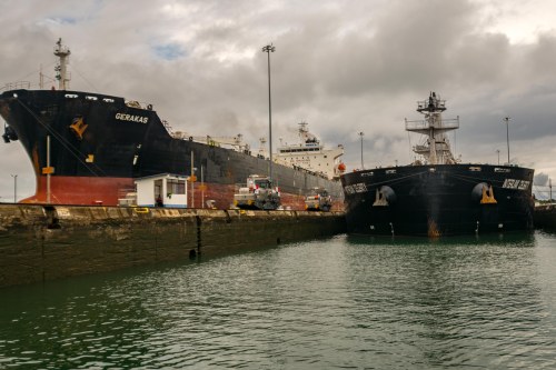
Sharing our bay is another large tanker.  For some reason in the lock bays where the height is lowered, smaller vessels go in first, and the larger tanker second. The tanker steams up behind us.  It doesn’t come fast, but it does bring scary images to mind as it moves up toward us.  Also sharing our bay is another tourist vessel, the Discovery.  It is smaller in length than our boat, but large enough to have a group of perhaps 20 people on board.

2018-11-15 11.50.56-1150.111518The Gerakas, the ship we accompanied at the Pedro Miguel Lock bay is in the bay beside us here.  It sits very high in the water compared to the ship coming up behind us, clearly empty of cargo.

We go through the process of lowering to the next level and then moving to the next bay in sequence, and then we are on our way to Colon.  The Discovery hurries on ahead of us.

2018-11-15 12.59.48-1259.111518It seems we have to wait for a spot to dock, so we spend quite a bit of time motoring around the harbor, first going by some interesting ships, then watching the cruise liner dock, and finally we get our chance.

The blue ship with the white top is a car carrier.  Tied up next to it is a tanker which says its cargo is liquified petroleum gas.  The ships off to our left side are smaller freight vessels. We haven’t seen any of these smaller vessels during our trip through the Canal, and I wonder if these are just used to haul containers around the distribution yard here.  The storage and distribution center here is at least as large as the one on the Miraflores end of the Canal.

Our trip through the canal has taken nine hours by the time we dock.  The plan allows for 12 to 13 hours, so our trip has been swift.

After landing, we find our bus, and it takes us through the town of Colon and to our hotel.  Tomorrow we will do some touring around, and get on board a train to take us back to Panama City.

Leave a comment

Filed under Blog, NAFEM

Road Scholar Trip to Panama, Nov. 11 – 17, 2018 Part 3

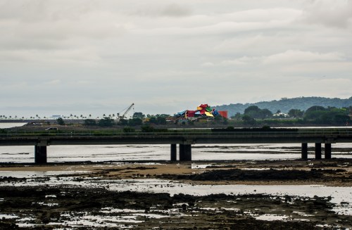
Wednesday, Nov. 14, 2018 — a long day in a bus.  Our trip today is ultimately to the first of the locks, Miraflores.  However, before we get there, we have some other places to visit.  Once on the bus, we head over the Bridge of the Americas, our first such opportunity.  Note the Biodiversity Museum on the left hand side.

IMG_2018Once we are over, we head into Panama City for a short shopping stop.  On the way, we pass below the terrace we stood on yesterday at the Panama Canal Agency’s headquarters.2018-11-14 06.26.47-2-0626.111418
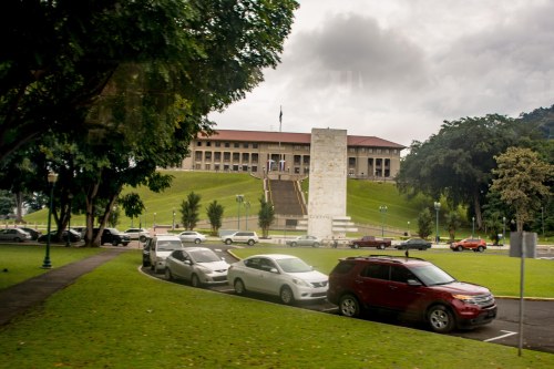
The store, called Rey, is huge;  certainly larger than any market I’ve been in lately.  It has a profusion of products, many of them US-sourced.

Perhaps the best comparison is Costco, or Sam’s Club, although the ones in Michigan do not compare in size to this store.

Time for an economics lesson: living accommodations.  In Panama City, many of the buildings that are viewed as part of the skyline are actually high-rise apartment buildings.  Out here on the edge of the city, there are many apartment buildings, just not so high. 2018-11-14 07.23.57-0723.111418Once out a bit further, the land use is a little different.  Juan Carlos tells us that many of the small houses built on the cleared land are squatters — people who put up shacks and make a home for themselves.

Once they have been there for awhile, they get together with their neighbors and demand city-like services: connection to electricity, water, sewer, garbage collection and so on.

Once those things are in place, they then claim the land they occupy, and they have successfully established ownership rights. 2018-11-14 07.46.32-0746.111418The houses we see along the way are in various stages in this process.  The farther away from Panama City, it seemed, the earlier in this process the buildings seem to be.

Our bus continues on, and our next destination is Madden Dam.  This dam, completed in 1935 was built to prevent the occasionally torrential flow of the once wild Chagres River from interfering with the navigational route for the ships through Gatun Lake and to control the level of water in that lake during the dry season. Water from the dam’s reservoir is also used to generate hydroelectric power and to supply Panama City with fresh water. 2018-11-14 08.04.47-0804.111418

2018-11-14 08.22.42-0822.111418Whenever we stopped along the way, we were visited by the police.  There is only one police agency in Panama, the National Police.  There are no independent city or other entity police departments.

Our bus driver, who was very good at finding animals along the way, pointed out crocodiles in the lake.

On the way to Miraflores Locks, we stop as our route crosses the Camino de Crusces, the historic road from Panama City to a small village on the Chagres River called Venta de Cruces.

2018-11-14 08.52.29-0852.111418

The cannon marks Camino de Cruces as it crosses the highway

In the sixteenth and seventeenth century, when Spain controlled Central and South America, gold would be brought to Lima, Peru and other main ports along the Pacific coast then shipped from there to Panama City.  It was then transported overland along the Camino de Cruses to Venta de Cruces.  There it would be put on small boats to transit the Chagres River out to the Caribbean and along the coast to Portobelo.  From there it would be put on ships for the trip to Spain.

Pirates were a constant danger.  In 1671, Henry Morgan reversed the path with an army of 1200 men, devastating Panama City, as well as Venta de Cruces, and taking 250 mules and 600 captives for eventual sale.

2018-11-14 11.25.49-1125.111418From here, it’s on to Miraflores Locks.  The visitor center sits across from the lock control center.  The control enter sits on the strip between the two parallel lock bay channels.  The viewing decks give access to watch the ships pass through the three lock bays on their way into or out of the Canal.

2018-11-15 06.08.27-Pano-0611.111518

We are told that the Control Area is quite spectacular, with electrically connected controls to perform all of the operations necessary to the operation of the lock bays, but much to the disappointment of our engineers, it is not on display for visitors.  When it was built, it was (along with many other aspects of the Canal project) a marvel of design, ahead of its time.

At Miraflores, each ship must pass through two lock bays.  Here, the Navig8 Turquoise, a chemical/oil products tanker, sits in the lock bay at full height, and then 15 minutes later, it been lowered approximately 27 feet ready for the lower lock gates to open allowing it to move to the second bay.

Now it has moved into the second bay, and 15 minutes later, it has been lowered to the level of the Pacific Ocean so it can continue, as shown below.

2018-11-14 12.56.55-1256.111418Ships carry many things in addition to the chemical and oil products carried by Navig8.  They all seem to have similar lines, but they vary widely within those lines depending on the actual cargo they are built to carry.  A couple of examples include

the Golden Rose, a bulk carrier, and the Dusseldorf Express, a container ship.

These large ships fit snugly within the walls of the lock bays, and well they might, as they were built to fit.  They move forward only on their own power, but to be sure they don’t bump the walls of the bays and damage themselves or the locks, the little engines, called “mules” that can be seen at the lower right in the last picture are used.  Through coordinated effort, lines tied to each of the mules maintain the right pressure to keep the tankers parallel to the bay walls.

Not too far beyond the lock bays in front of us can be seen a ship moving parallel to the ships going through the locks.  It’s larger than the ships in the near locks, and it is going through a new set of locks designed and built starting in 2004, and opened for business in 2016.  These locks enable ships carrying up to 13,000 40-foot containers to go through Miraflores.  We’ll visit the parallel new lock structure at the other end of the Canal (Agua Clara) in a couple of days to get a closer look.

We have dinner in the restaurant here at the visitor center, and then head back to the hotel.  Tomorrow, we sail through the Panama Canal!


Leave a comment

Filed under Blog, Uncategorized

Road Scholar Trip to Panama, Nov. 11 – 17, 2018 Part 2

Monday, November 11, 2018 — the first day of our official Panama Canal tour, and arrival day for everyone else.  We spent the day relaxing and reading about our adventure ahead.  We ate dinner at the hotel’s independent restaurant, TGIF’s.  It is a bit of a surprise to see this restaurant here.  The offerings on the menu are not significantly different than what I would expect to see at any TGIF’s in the US; definitely not local Panamanian fare.

Tuesday, November 12, 2018 — we meet after breakfast and spend a little time getting to know one another.  Our group numbers around 43, so it will not be possible to get to know many of them in this short week.  Many are retired (like us), and as might be expected there is more than one admitted engineer. interested in the design of the canal and the details of how it was built.  We have three group leaders (Juan Carlos, Rey and Gabe), each offering his unique perspective on the canal, its history and context including the current political situation here and the flora and fauna of this country carved out of the rain forest.  Juan Carlos is of an age with our son Kyle, and like him, he has a new-born keeping him and his wife awake at night.  He is the leader of the leaders.  Rey is the veteran of the crew, perhaps in his 60’s, he lives in the Colon side of the canal, and has done a number of things in his long life.  He provides the perspective of one who has lived through the transition of Canal control from the US to the Panamanians in 1999.    He was employed by the US prior to the transition, living and working on one of the US bases we will visit on that side of the Canal later on.  Gabe is the youngster of the crew, and our expert in residence on the rainforest and its residents.

Next up is the tour of old town Panama, so we load up three small buses (the local streets are too small for the standard-sized tour bus we will use the rest of the journey), and off we go.  On the way, we pass by this local monument to Dr. Arnulfo Arias Madrid. He was founder of the Panameñista Party and a three-time president of Panama during the 1940s. Each term ended prematurely by a military coup. The ensemble depicted on the monument represents the classes of citizens who followed the popular political leader.

Our first stop on the tour is the Headquarters of the Panama Canal Agency, an arm of the national government.  Our tour leaders take us to the central rotunda of the main building, a place that has the feel of a small version of the US capitol building.  Our group fills the rotunda completely.  Above us are four paintings depicting scenes from the build process.


2018-11-13 06.46.10-0646.111318This picture depicts the bulk of the digging and rock removal.  Digging the Culebra Cut, the place where the canal cuts through the Continental Divide, was one of the major engineering marvels of the whole construction.  It remains the narrowest place along the canal route, and the reason that the canal is a one-way traffic only operation.

2018-11-13 06.46.05-0646.111318This next picture depicts a railroad structure.  Temporary railroad tracks were laid to move heavy equipment to the Cut, and more importantly to transport the dirt and rocks blasted out on a daily basis to the designated landfill areas.  Upon completion, the peak of the Continental Divide had been reduced from 210 feet above sea level to 39 feet across a 299-foot-wide base.  This effort required the removal of approximately 120 million cubic yards of earth and rock.  For comparison purposes, a so-called half-ton pick-up truck can carry approximately half a cubic yard of dry aggregate material.  The bottom of the Cut at 39 feet-above-sea-level is covered by water to bring it up to the 83 feet-above-sea-level of the Gatun Lake water contained between the locks of the canal enabling the large vessels to travel safely through.  The surface of the water at the Cut is approximately one-third of a mile (1760 feet) across.

2018-11-13 06.46.27-0646.111318Continuing around the dome, this picture is centered on the circular drainage culvert running between two side-by-side lock bays.  This central culvert is 18 feet in diameter and is connected to smaller culverts that run below each of the bays.  The picture also shows several of the different types of cranes used to move equipment, concrete, framing timbers among other things around the lock sites.

2018-11-13 06.46.18-0646.111318The last picture gives a closer view of the framing and structure of the miter gates (so called because they come together in a wide “V” shape) used to hold the water in or out of each lock bay.  Each gate leaf is 64 feet wide by 7 feet thick, varying in height from 47 to 82 feet, depending on the bay’s height.  Hinted at in these pictures is the science and engineering developments necessary to form, mix, shape and let harden appropriately the concrete used.  Concrete is a precise mixture of sand, water and cement with rock of defined size.  Construction use of concrete is something that was new in the late 1800s, and use in the quantities and structures of the Canal was unprecedented.

Beyond the rotunda our leaders took us to the terrace looking down on a small park with the Goethals monument at its center. 2018-11-13 07.05.06-0705.111318Colonel George Washington Goethals was appointed Chief Engineer of the Panama Canal in February 1907 by President Theodore Roosevelt.  The president had decided after some wrangling with interested parties that it was best to have the Army Corps of Engineers run the canal construction instead of an independent contractor.  Goethals managed the job to a successful conclusion two years ahead of schedule.  He was widely acclaimed for his work on the Canal, garnering numerous awards and accolades. In 1914, shortly after completion, President Woodrow Wilson appointed now General Goethals the first civil governor of the Panama Canal Zone.  He left this post in 1916 to become Quartermaster General of the US Army as the US was preparing to enter World War I.
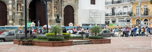
Now it was back to the buses and on to the old town of Panama City.  The first stop on this walking tour was the Panama Canal History Museum, where we received our first instruction in the more detailed history of the building of the canal.  After we completed this, we walked to Plaza Mayor.  Here we had an unscheduled stop as a group of protestors were walking around the plaza announcing their concerns with loudspeakers.. 2018-11-13 08.43.38-0843.111318Juan Carlos explained to us that they were retirees who were complaining that the Panamanian version of Social Security was not sufficient for them to live on.  He explained that the average monthly entitlement was around $250.  This is far below the minimum wage of approximately $600 per month, so the protest was reasonable.  He also said this was part of a yearly process, and in the past, such protests had led to improvements for the retirees.

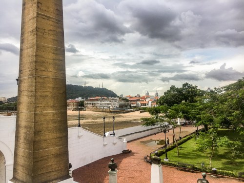
When we were allowed, we continued our tour.  Shortly thereafter, we came upon the ruin of Saint Dominic’s Church.  The major feature of this ruin is the internal arch which supported the choir, designated the Flat Arch.


This arch (15 meters long and 10 meters high) was a popular tourist attraction in the 19th century, despite being part of a ruin.   It was declared a national monument in 1941.  Unfortunately, for reasons unknown the arch collapsed in 2003, but has been rebuilt with the same bricks.  The photo was taken from the terrace where Gwen is relaxing.

We continued on to the Plaza de Francia, as Gwen and I had seen it the day before on our own walking tour.  The picture below, taken from the walkway shows the obelisk and if you look closely, you can see the twin towers of the Cathedral at Old Panama.

IMG_1804-1434.111218

Spinning about a quarter turn from this spot, off in the distance can be seen the distinctive roofline of the Biodiversity Museum.  After a brief stop for lunch, our tour group broke into parts, and I chose to visit this museum.

IMG_2016

Situated on an isthmus that parallels the Canal entrance channel, close to our hotel, the Biodiversity Museum provides a look at the biological history of Panama in the context of the the broader biological history of the Earth.  The museum discussion starts with some broad statements about what biodiversity is, then we are drawn down a corridor leading to a diorama of life size animals all of whom have lived in Panama at one time or another.

Down below the diorama there are columns with pictures and stories concerning the change of biological life from prehistoric to modern times, with some further discussion concerning future problems and efforts to solve those problems.  After that, it’s on to the biodiversity gardens outside the building.

The building’s architecture is even more colorful when seen closer up.

Fascinating information: did you know that plants reproducing via seeds, the predominant method used by the vast majority of flora in today’s world is only the latest mechanism?  From 350 million years ago until 280 million years ago, plants reproducing through spore production dominated the damp rainforest-like landscape.  As the earth continued developing, the continents separated and dryer land became common, the much more efficient seedling approach became dominant.  This information, along with example gardens developed around the theme of sustainable food production with walkways around and through form much of the area behind the building.

There, as well, is another spectacular example of those large fig trees with roots extending from and supporting its branches.  On the one side of this area is another spectacular view of the Panama City skyline,

2018-11-13 12.56.41-1256.111318and from the other side is a grand view of the Bridge of the Americas, the bridge we’ve seen from several angles before.
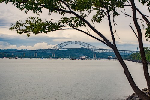
2018-11-13 12.51.54-1251.111318From here it is a simple walk back to the hotel.  Well, maybe simple, but longer than anticipated.  Along the way, there were some interesting sights.  A great heron caught my eye.

There were also several large houses that upon closer examination appeared to be abandoned.

The tour group gathered again later in the afternoon and heard an excellent presentation given by a gentleman named Jaime, who has worked for the Canal Agency since before it was turned over to Panamanian control.


Leave a comment

Filed under Blog

Road Scholar Trip to Panama, Nov. 11 – 17, 2018 Part 1

Early in November this year, I turned 70.  My wife Gwen and I have gotten to the point where celebrating birthdays and anniversaries only happens when they end in 0 or 5.  Otherwise, we acknowledge it but don’t do anything special for it.  For this one, we decided that a trip to Panama would be a celebration we both would enjoy.

Our usual method of choice for such trips is Road Scholar, as we enjoy the educational aspect to their tours, they are well-prepared, populated with friendly folk, and we’ve enjoyed them several times in the past.  This one is no exception.

On Sunday, Nov 11, we travelled from Los Angeles Intl. Airport to Miami to Panama City, Panama.  This was a long trip, but comfortable, as the plane rides were more or less on schedule.  We arrived late in the evening, and took a taxi to the Radisson Hotel for a comfortable day on Monday, and then the first meeting with our tour group on Tuesday.

Monday morning, we got our breakfast and began our holiday by studying our surroundings.

2018-11-12 06.23.47-0623.111218

Out on our balcony, we have a clear view of the Panama Canal.  It turns out all of us on the tour have rooms on this side of the hotel, thanks to our tour leaders.  To the left are several ships probably lining up to take their turns to go through the lock systems, headed from Panama City (the Pacific side) to Colon (the Caribbean side).

2018-11-12 06.20.09-0620.111218

To the right, we have a great view of the hotel’s huge pool area with the Panama City auto bridge in the background.  Panama City has grown into a large metropolis, and many of the people who work there live outside the city.  They are building two more bridges to help ease what we are later told is a Los Angeles-size traffic jam every week day.

2018-11-12 08.47.59-0847.111218

We also get our first view of one of the large container ships making its way to the first of the canal’s locks {just beyond the bridge}.  We would learn that this ship, while large, is not the largest now accommodated by the locks.


We took a stroll around the hotel, and came upon this unusual tree.  It’s huge, and its most distinctive feature are the roots that drop from the branches embedding themselves in the ground below to find nutrients and to help hold up the branch.  These are fig trees; we had seen similar ones in Hawaii.

Monday afternoon, we decided to take a taxi into the old town of Panama City (Casco Viejo), even though we knew we would see parts of it again on Tuesday with our tour group.  Mainly we wanted to get an opportunity to try a local restaurant and enjoy the good weather afforded to us.

IMG_1787-1349.111218

The taxi driver dropped us at his recommendation for a good place to eat: the Casablanca Cafe, located across from the Bolivar Square.

The paella is tasty with spice, but the fish bits are rubbery and thus unappetizing, unfortunately.  Gwen’s chicken in sauce dish was bland, so this place does not get our recommendation.  As we are at Bolivar Square, however, we decide to take a look around.  Simon Bolivar lived in the early 1800s, and was the most memorable of the political and military leaders in the fight to free the central and south American peoples from domination by Spain.

On the other side of the square, behind the statue, is the Iglesia de San Francisco de Asis.

It is a pretty church, and we enjoyed visiting the sanctuary with the tremendous altar.  Encouraged to continue our self-guided walking tour, we come upon the Plaza Mayor, and to one side is the Cathedral at Old Panama, or the Sacred Heart Cathedral (SpanishCatedral Basílica Santa Maria la Antigua de Panamá).  or the Metropolitan Cathedral (Catedral Metropolitan).  It is  currently closed for renovation in anticipation of the Pope’s visit in 2019. IMG_1795-1414.111218The outside is quite spectacular, making us wish we could have seen the inside.  It was built starting in 1688, and finally consecrated in 1796.  Why does it have so many names?  I am not patient enough to wade through the internet references to find the answer.  It probably has something to do with its age, the specific congregation it serves, or perhaps the level within the Catholic hierarchy of the religious leader to whom it serves as home.  Maybe all three.  I did find that roughly 69% of the Panamanian population regard themselves as Catholics, thus explaining the Pope’s pending visit and the number of such churches we have seen in our walk.
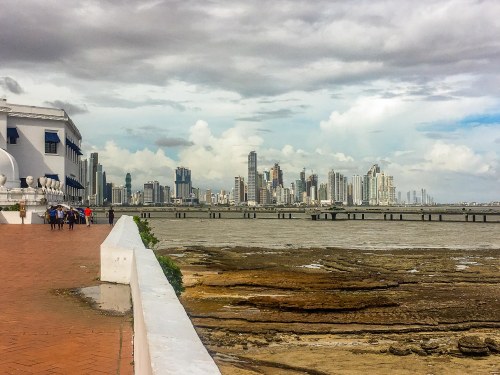
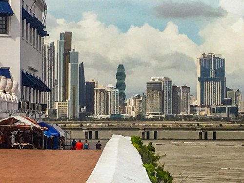
We continued our tour, eventually finding ourselves in a park that juts out into the body of water that serves on one side as the entrance to the Canal, and on the other borders downtown Panama City.  This is the Plaza de Francia, with the Instituto Nacional de Cultura as its central building and a giant obelisk as its central attraction.  A stairway winds around the obelisk and up to a walkway above the Cultural Institute, and so I leave Gwen at the bottom of the stairs and climb.  At the top is a view to a highway raised just above the water running all the way around this little peninsula.  Looking to the left, I am treated to a breathtaking view of Panama City’s skyline.

IMG_1798-6-1433.111218

The picture does not do justice to the view, especially the first time I saw it.  The airport is on the other side of the city so we’d been driven through these buildings the night before, but I didn’t realize how spectacular the city’s architecture is until getting this view.  Like any city skyline, the buildings are each distinctive in their own way, but most emphasize the vertical geometry as they reach for the clouds in the sky above.  The one exception in this skyline is the one pointed at by the thick white wall that borders the walkway. IMG_1800-1434.111218Instead of emphasizing the vertical, this one twists as it rises and glows with a curious green color.  2018-11-13 09.06.21-0906.111318-2
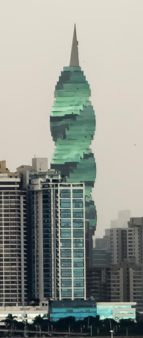
This building is the F&F Tower named for the construction company that built it.  Called the Revolutionary Tower on the drawing board, this office building was opened in 2011.   Designed around the themes of a rotating geometry and a prism, it quickly became and remains one of the most iconic buildings in Panama.

Gwen shortly joins me on the walkway, and after we admire the view some more, we continue walking, enjoying the sights, eventually finding a taxi and returning to the hotel.

Leave a comment

Filed under Blog

Hawaiian Holiday: 12/25/16 to 1/6/17 #3

Sandy, Victoria and Seth left us on Sunday January 1, 2017 and went back to their home in San Rafael, CA.  For the rest of us, it was on to the Aulani Resort (a Disney facility) on Oahu.  This transition went very smoothly, and we began enjoying ourselves right from the beginning.  The Aulani is on the western coast of Oahu, about 45 minutes from the main airport, and somewhat away from Honolulu, although how far is difficult to tell.  We stayed mainly at the resort, although on one day we ventured out to explore a bit more.

On that day, Courtney, Joey and I went to the Pearl Harbor memorial, while the rest of the crew went to various places around the island, including the Dole Pineapple plant, a spectacular donut shop, and other places.  We had only one car, so they dropped us off first, and we were able to spend most of our day at the memorial site.

The site is officially called the “World War II Valor in the Pacific National Monument”, which actually includes a number of related memorials located across the Pacific.  It includes the Visitor Center where the museum, theater, the submarine Bowfin and its museum, the ticket office and assorted eating places are located.  The harbor boat to the USS Arizona memorial leaves from this site as well as frequent buses to the USS Missouri and the Pacific Aviation Museum, Pearl Harbor, both located on Ford Island.

The most difficult ticket to obtain is the one to the USS Arizona memorial, as they only issue them the day before or the day of your visit.  We had tickets for the 1:00 tour, so we had to be in the line for the theater by 12:45.  As it turned our we made all our connections all day, so we spent the maximum time site-seeing.

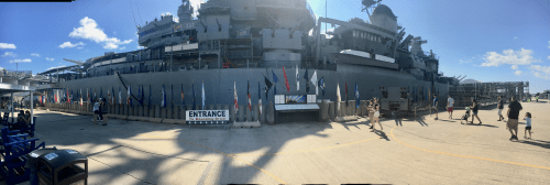
First stop was the USS Missouri.  This is the ship where the Japanese government signed the Instrument of Surrender document in September of 1945.

img_0637

This is an excellent example of the Battle Ships that populated Ford Island’s piers on December 7, 1941.  There were eight of them, and all of them were harmed  by the bombing.  The USS Missouri was not there, as it was built between 1941 and 1944.  It is an Iowa-class “fast battleship” which saw service in WWII, the Korean War, and finally the first Gulf War.  She was “permanently” settled in Pearl Harbor in 1999.

The first picture is looking across the teak deck of the ship at the Arizona memorial.  I was unaware that ever since they started building metal ships, they have decked them in wood.  To those of us who do not spend a lot of time on board ships, the practical reason may not be obvious.  The wood decking provides needed insulation.  We were told it also is a tribute to the wooden ships of old.

The circle above marks the spot where the desk sat upon which the Instrument of Surrender sat for its ritual signing. The second picture is looking up from that spot at the guns and the equipment on the decks above the main deck.  The third picture looks across the harbor to the main island.

The next stop for us is the USS Arizona memorial.  We get back to the Visitor Center in plenty of time to make the cinematic presentation which precedes the boat ride to the memorial.  The film is quire good, explaining the context of December 7, 1941, and in particular what happened to the Arizona (a bomb designed to break through the top decks and detonate close to the ship’s hull actually did that, and ended up exploding in the ammunition store, detonating much more than just itself).  The Arizona sank quickly, and became the gravesite for over 1100 men, the largest single-ship loss of life that day.  After the movie, we all boarded a ferry for a 15 minute ride to the memorial.

The picture immediately below shows the largest stack still visible above the water.  A smaller stack is closer to the memorial itself, showing a ladder and electrical cables which have been cut.  In the center of the memorial, a square is cut out showing another stack on the upper right.

The top picture below shows the plan of the Arizona as it existed on that day, as well as the  way the memorial straddles the remains as they sit on the bottom below it.  The smaller picture on the left below shows oil seeping from the Arizona’s tanks.  This oil comes out in drips, dissipates colorfully and disappears, soon followed by another.  This has been going on since 1941.  ON the right below is the rear wall of the memorial, where the names of the men who died are listed.

Courtney and Joey said later they very much enjoyed seeing the memorial, and the associated museums.  The Missouri is in the background in the pictures below.

Our next stop was the USS Bowfin, one of the many submarines in service in WWII.  The Bowfin saw service from her commissioning in mid-1943 until the end of the war, and then in the Korean War.  She served as a training vessel for a number of years, and was finally sited at Pearl Harbor in 1971, and listed as a National Historic Landmark in 1986.

Viewed from the deck, the Bowfin is a sleek and efficient fighting machine.  However, to make this possible, the machinery and crews areas are efficiently laid out, but not very hospitable to the crew.  This is especially true of the hatches, which were not easy for me to maneuver through at my height and age.  Beds seemed to be everywhere, which they more or less had to be to accommodate the 80 man crew aboard the 312′-long by 28′-wide vessel.  In addition to the beds, of course, also inside are the diesel-electric propulsion system and numerous torpedoes, their main weapons.

Her service record is quite good, as the flags on her outer shell indicate.

img_0727

The Bowfin museum was very enlightening as well.  It gave me quite a lot of history of submarines in general (starting in the Civil War), and Joey and Courtney spent their time on more recent developments.

The last stop on our tour was the Pacific Aviation Museum.  The museum is also a WWII memorial , and the exhibits in it are primarily WWII related.  The picture on the left below is a painting of what a zero pilot would have seen on December 7, 1941.  The top picture on the right is of a fully reconstructed zero.  The zeros were technically ahead of anything else in the sky at that time.  In the hands of a well-trained and experienced pilot, they could outmaneuver anything we could put up against it.  That changed over the first year of the war in the Pacific for two reasons: the Allies obtained an in-tact example of a zero and the number of well-trained experienced pilots flying for Japan dropped swiftly especially with the Battle of Midway six months after Pearl Harbor.

One of the sidelights of that infamous day were the six private pilots up over Oahu who, once they figured out what was going on, scrambled to get on the ground and out of the way as soon as possible.  One was a young lady, a flying instructor and her student.  They got down successfully, and she (I can’t remember her name) shortly thereafter went into training in Texas to become one of the women flyers taxiing completed aircraft from the US to bases abroad where they would be used for the war effort.  Unfortunately, she was killed during the training sessions.

At the back of the Museum is a line-up of flight simulators.  Courtney was brave enough to try it, and duly took her place as seen below.  The simulators were loosely enclosed, with meters appropriate to the type of aircraft flown on a computer screen in front of them, a joy-stick control, and a large screen projection of what they would see out of the windscreen in front of them.  The picture on the right shows Courtney taking a hard right following her target (one of the other simulator pilots), which the picture on the left shows the con trail indicating her success at shooting him down.  The picture on the right of each picture below shows the type of aircraft simulated.  It looks like the P-38, which was the primary US fighter during most of the war in the Pacific.

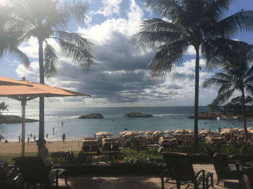
Below is the view toward the ocean at the Aulani.  The featured image on this page shows the Aulani as seen from the beach.  We really enjoyed our stay there.

img_0773


Leave a comment

Filed under Uncategorized

Hawaiian Holiday: 12/25/16 to 1/6/17 #2


While we were on Kauai, probably the best visit for me was the Na ‘Aina Kai Botanical Gardens.  This park, first established by Joyce and Ed Doty in 1982 was turned into a nonprofit in 1999 and opened to the public.  It contains 13 different gardens now, populated with many different kinds of plants, buildings, and (my favorite) over 90 statues.  While I enjoyed the flowering plants for their color, and the hardwood forests for the wood they would be producing (as an amateur woodworker), the numerous ,creative and unique sculptures I appreciate for their artistic merit and in many cases whimsical beauty.

We had a guided tour through the park, sitting on an amusement park-like open cart.  The guide and his wife have been conducting tours for 17 years, and knew quite a lot of stories about the park.  They were careful to point out many of the more interesting aspects as we went along.

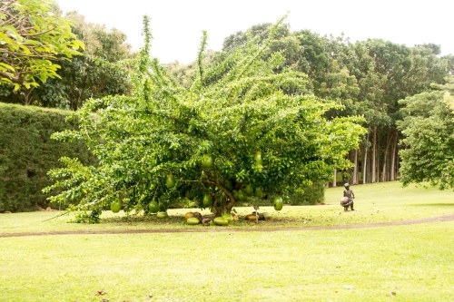
Speaking of trees I’ve not seen before, here’s one.  The “bottle gourds” are as large as watermelons.

20161230-dsc_7394

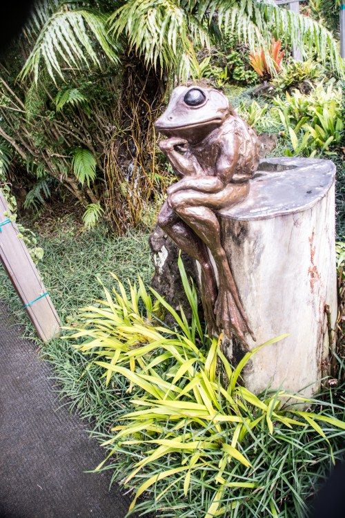
As great as the earlier sculptures were, the next one really caught my eye and imagination.   Entitled Mr. Cheesencrackers.

More interesting plants.  Courtney is holding an example of the flowers traditionally put over a young lady’s ear, while Joey and the group are looking at a version of cotton.  They are staring in the third picture at a Sausage tree.

The pig in the first picture is Mr. Royal Hindness, while the group talking to Seth and Sarah are the Conspirators.

Joey has a Rambutan, one of the many fruits found to Kauai, but not in too many other places.  Sarah has another.  The yellow flowers  in the third picture are about the size of a grapefruit when fully open.

More statues: The baby elephant is having Stage Fright, while the other two are more obvious.

Next are two views depicting the experienced fisherman describing the One Who Got Away to his young and eager listener.

The next garden is a native Kauai village, populated by many sculptures.

The children’s garden is next.

Sarah enjoyed playing in this garden.

The next area looks more like a western US set-up than anything to do with Kauai.  The whole area is called “Navajo Country”.

The sculptures are very lifelike in this area, done by extremely skilled crafts people.  I especially like the juxtaposition of some of them.  The coyote chasing the rabbit above, and the playful fox pouncing on the mouse below.

The next area is bordered by hedges with occasional red blossoms.  The area is desert flora.  Notice the rooser in the lower picture — they are everywhere!

More sculptures:  the paper boy’s bicycle is unique in that it has no spokes.  The cat is entitled Silent Pause”.

One of my favorite sculptures is near here, called Valentine

Some of the more exotic plant life (Gwen is our resident botanist — ask her about “moss lawns” sometime…)

In 1982, when they first established the gardens, the Doty’s built their first house on the original 13 acre estate.  This house has its own exotic flora and pond.  They’ve since built another house, as the estate has grown to 240 acres for themselves, but this house is still in use by those running the gardens.  Joyce Doty is still alive, and takes an active interest in the guidance of the gardens, forests and parklands of the estate.

The house sits where it can look out over a promontory at the ocean beyond, but in the garden you only get a glimpse of that view.

20161230-dsc_7638

There is a boxwood maze, compleet with stone sculptures at the dead ends, and an area above where people can sit.

There are blossoming trees there, as well as Royal Palms bordering the area.

As Sandy and Gwen sat in the covered bench, they looked out on these sculptures.  It took a minute to understand the boy’s animation, as the rabbit is not casually spotted (the title for this pair is Lively Encounter).  The girl on the swing is also a conundrum waiting for the unsuspecting.  You slowly realize that the swing is only half there, with its one rope not even reaching the tree, yet it stands stably for all to see.  The sculptor, George Lundeen, named it Hearts on a Swing with pun intended — he met the young model as she sat for this sculpture, but they went on to get married.

A large lake surrounded with a variety of plant life and sculptures came next on our tour.

Above the large pond is a Tea House, complete with rock garden.

A day in the park.  Frozen in time in the form of the sculptures.  Sarah enjoyed the dogs, but my favorite was the old man and his granddaughter!

The last jaunt was out a long dirt road which topped a ridge leading out to overlook the ocean.  We stopped along the way as it is breeding season for the seabirds.  Thus they build nests in the pine needles in as protected an area as they can find.

At the end of the drive the ocean spans out before us!

And then its back to the visitor center for some Heavy Thoughts.

20161230-dsc_7808

Leave a comment

Filed under Uncategorized

Hawaiian Holiday: 12/25/16 to 1/6/17 #1

Oh what high expectations we had for this holiday!  And it was to start with a week-long family vacation to Kauai thanks ito the timeshare of Sandy and Victoria.   Gwen and I, Kyle (our son) and Suzie (his wife, 6 months pregnant), Courtney (our daughter), Joey (her fiancee) and Sarah (her daughter), and of course Sandy (Gwen’s sister), Victoria (her partner) and Seth (their son) all in attendance.

Off Gwen and I went to Kauai on Christmas day.  Sandy, Victoria and Seth were to precede us by a couple of hours (flying from SF to Maui to Kauai), while the rest were to join us the next day.  The flight to Lihue, Kauai (yes, unlike 44 years ago when we honeymooned in Hawaii, each major island now has its own airport large enough to handle the big jets) was quiet and uneventful.

Upon arrival, there was a phone message from Victoria with very disturbing news: Sandy had developed a medical problem just before they were to depart from Maui. As a result, she was hospitalized there, going through the process to determine what had happened.  A worried call to Victoria ascertained that Sandy was stable, thank goodness, but the doctors were yet to complete the tests necessary to determine what had happened, so of course no prognosis was yet available.  OK, problem 1: there was some possibility that we would have to move the whole party to Maui if Sandy was declared unable to fly.  Chances were, however, that she would recover sufficiently to make Kauai, but perhaps a day or two later.

Gwen and I proceeded to the timeshare, duly reserved by Sandy, and reconfirmed two days previously.   Problem 2: when we arrived, they could find no records of any reservation. It was as you will remember, Sunday, Christmas day.  Highest week for Hawaii’s long tourist season. The timeshare agency was as helpful as they could be, but spare accommodations for ten people for a week on Kauai was just nonexistent. They did find a suite to put the two of us up for one night, so tonight’s problem was solved. Sandy was the key because she had made the reservations.  But she had no written confirmation, and her electronic confirmation was on her computer back home.  They’ve been involved with this timeshare company for many years, and had never had any problems before.

Gwen was working hard with the timeshare folks, and with one of her college roommates, Sylvia Woods.  We were looking forward to spending some time with Sylvia while in Kauai, as we hadn’t seen her in over four years.  At that time, she made the move to Kauai, making it her permanent residence.  So, Christmas day ended with Sandy feeling better, but no answers on the travel to Kauai front, and Gwen and me sheltered for one night.

The next day Sandy was doing better, but still undergoing tests.  Much work was needed, however, to find accommodation for all of us.  Thanks to Sylvia’s friend, Marsha, by the time we picked up Courtney, Joey and Sarah, we had reservations for that night sufficient for all except Gwen and I.  We eventually took the three of them to the Westin Resort in Princeville, and when Kyle and Suzie arrived late that evening, they went straight there, our temporary haven.  Sylvia was kind enough to put Gwen and me up for the night.

The next day, things finally began to get resolved.  Happily, Sandy was getting better, and the doctors finished their testing.  They couldn’t find anything wrong, and determined she could fly to Kauai, and so she, Victoria and Seth made those arrangements.  In the meantime, Victoria got on to the timeshare folks by phone, and found out (eventually) that their international reservations group had been hacked.  Someone had gotten into their computer system and re-sold the timeshare weeks, wiping out our reservations (and presumably others), pocketing the money.  The timeshare company decided to take the financial responsibility, so the only problem left for us was to find places to stay.

It was Kyle who resolved this last aspect of problem 2 for us once and for all.  He got onto the internet and discovered that even though all the humans at the Westin were unable to find us any rooms, they indeed had enough for us all over the time we planned to be in Kauai if we reserved them through his favorite internet app.  So  Kyle booked reservations for us online, and we all happily checked in.

By the evening of 12/27, we were finally all together on Kauai, and ready to start our delayed vacation.

The next day we spent our time investigating what the Westin had to offer, mainly swimming and sunbathing.  Sarah spent much time in the pools, accompanied by one or more of us adults relaxing for the first time since we got to the island.

Sylvia told us that up at this end of the island (Princeville is on the northeast corner of Kauai), we were close to the Kilauea Lighthouse and National Wildlife Refuge, so one of our first trips was to this historic landmark.

The point on which the lighthouse stands, we are told is an excellent vantage point for seeing saline, like whales and seals and the like.

We saw none of that kind of thing, but we enjoyed the views very much.

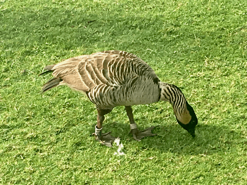
The wildlife we did see was of the flying variety — the Nene bird.  This state bird is endangered, we were told.  The bird is about the size of a Canadian goose, which we are also told is a relative.

img_0547

The next day, we decided to go in the other direction, down to Hanalei town and the beach beyond it.  We started out with a late breakfast at a “lunch wagon” called Fresh Bite.  Ten people ordering at once turned out to be quite a tall order for them, but as long as we were willing to wait, they were more than happy to serve us.  Wait we did, but in the end, they provided a surprisingly good breakfast as agreed by one and all.

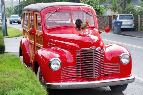
Walking to Fresh Bite, we noticed this restored red “woody”, complete with a chicken standing where the hood ornament should be.  It, as we quickly discovered, was artificial.  We had already noticed that the island seemed overrun with the birds.  They provided a morning chorus every day we were there.20161229-dsc_7158

After breakfast, we made our way to the beach.  Gwen and Kyle quickly got their feet wet, but were soon joined by Suzie.

Sarah was not far behind.  She and Kyle enjoyed jumping up just before the wave hit.  Gwen and Suzie were so concentrated on watching the fun, that the wave soon got to them as well!

Soon all were on the beach.  Victoria and Sarah decided to bury a coconut.

Seth and Sarah spent time catching waves on the beach, and all spent time talking and enjoying the sand.

It was cloudy and getting cold, so we decided to go back to the resort.  The resort sits on an overlook well above beach level, so there were some opportunities to get a broader view of the area as we drove along.  The first below shows the valley that leads to the town of Hanalei and the beach to its right, while the second one shows the rain coming down on  the hills beyond the beach.

20161229-dsc_7314-pano20161229-dsc_7322-pano

The road to Hanalei town took us past a very interesting warning sign, immediately followed by a one-lane bridge, which in its turn was followed by another strange warning sign, which turned out to have immediate meaning.

You know you are in Hawaii when you see large red flowers high up in the trees by the road.  For some reason, the pine trees have seem tall and spindly against their continental cousins we are more used to.

Other strange plants include the Hala tree below, whose branches seem to grow down into the ground rather than up to the sky.  Lots of colored flora adorn the garden areas around the Westin resort.

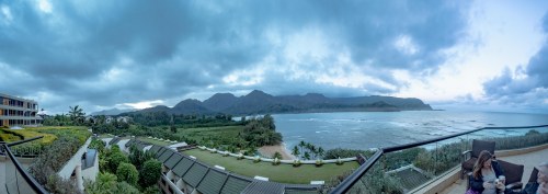
Next door to the Westin is the St Regis, a related resort, with marvelous views over Hanalei Bay.  We went over there to take advantage of the viewing deck (and their excellent restaurant, but that was a different time).  We watched a sunrise one morning.  Unfortunately, we were not on the side to see the best color.  I do love to watch the colors changing on the clouds as the sun comes up.

20161231-dsc_7830-pano


Leave a comment

January 18, 2017 · 5:30 PM

Fabulous Trip to Africa, 22 Sep to 4 Oct 2015, Post 12 – Nairobi

We got up this morning (without a wakeup call, for once), and got our breakfast downstairs. At 8:30 we were off in a different van, but still with Charles. Our first stop was the Giraffe Center, where the guide gave us a very well done presentation on the three subspecies of giraffe in Africa, and the many activities the Center is involved in to not just rescue babies and heal sick ones, but more now to educate the community in general on the value of the animals to Kenya now and for future generations. We then went to the platform where we got up on the second floor and with food provided for us to give to them, fed two adult females and a youngster that were there.  Down on the ground, there were four warthogs making sure that none of the feed that didn’t get to the giraffes went to waste.

20151004-DSC_5315 20151004-DSC_5319 20151004-DSC_5320 20151004-DSC_5326 20151004-DSC_5332 20151004-DSC_5342 20151004-DSC_5345 20151004-DSC_5355 20151004-DSC_5359

Got some great pictures of Gwen, Dee and Gretchen holding food in their mouths so one or another of the giraffes could give them a “kiss” to get it.

20151004-DSC_5369 20151004-DSC_5380 20151004-DSC_5390

We toured the rest of the Center, including an area where they had some giraffe bones, enabling us to see just how bid the animals were.  20151004-DSC_5399Gwen got a good view of a giraffe jaw, for example.

We then went off to the David Shellbeck Wildlife Center, which specializes in caring for elephants and rhinos that are orphaned in the wild. In both cases (the giraffe and elephant centers), the idea for the orphaned animals is to put them back into the wild when they are old enough, and when they can find a place in the animal society. After gaining entrance to the Wildlife Center, we walked down to an arena where there were already elephants drinking what looked like milk from large containers (it wasn’t milk, but a mixture of nutritional components that David Shellbeck had taken 30 years perfecting to maximize the opportunities these orphans had to survive childhood).

20151004-DSC_5412 20151004-DSC_5415 20151004-DSC_5420

One of the younger (and they all were young) and smaller elephants fell into the central pond, but was able to make his way out without a lot of trouble.

20151004-DSC_5433 20151004-DSC_5442 20151004-DSC_5448 20151004-DSC_5451 20151004-DSC_5469 20151004-DSC_5479 20151004-DSC_5501 20151004-DSC_5522 20151004-DSC_5527

The area inside the arena had a couple of watering holes, where the elephants can play and get wet, and plenty of dusty clay to throw on their backs to keep the sun off.  The elephants were there to eat, and you can see the large “milk” bottles in a couple of the pictures.  T

20151004-DSC_5556 20151004-DSC_5578 20151004-DSC_5591

The keepers had some leafy branches and a soccer ball in the arena as well for the elephants to play with (and a couple of ostrich females that were there as well). The ostriches ate the leaves on the tree branches more than the elephants, but all seemed to enjoy their time in the arena. One of the keepers took to a microphone and told about the work done by the Center, and then proceeded to introduce each of the elephants by name, age and reason for being there.

That was quite a thrill, but after that was finished and they took the first group back out of the arena, a second group was brought in and the process started again. There were about 30 elephants total between the two groups.

That ended the show, and so we headed off to a restaurant with outdoor seating where we enjoyed a very nicely prepared lunch off the menu.

Firefinch, Red-Billed

Firefinch, Red-Billed

Afterwards, Charles drove and Philip introduced us to the various buildings in downtown Nairobi. As it is Sunday, traffic was not that bad (it was bad enough), but we were told it is much worse during the week.

20151004-DSC_5634 20151004-DSC_5635 20151004-DSC_5647 20151004-DSC_5653

Eagle, Tawny

Eagle, Tawny; a city park dweller.

20151004-DSC_5666

Stork, Marabou

Stork, Marabou. These storks abounded in the city, much to our surprise.

Well, we are now back in the Eka Hotel, resting and getting ready for our trip back to the airport and our farewell to Nairobi, to Kenya, and to this safari adventure!

Leave a comment

Filed under Blog, Travel to Africa

Fabulous Trip to Africa, 22 Sep to 4 Oct 2015, Post 11 – Masai Mara to Nairobi

20151003-DSC_4937 20151003-DSC_4941

Back to Nairobi by airplane today. But we had time for one last short safari in the morning to try once again to find the male lions. We were out at 6:30 am, and bouncing along the back trail from our camp. Sammy, the driver, worked with Philip. 20151003-DSC_4952The first good thing: the sunrise, and the six balloons aloft to catch the morning light. Beautiful!

After that, we saw some birds (storks, vultures, ground birds), but no lions. Then, off in the distance, Philip spied what we were looking for. We were across the river from the two male lions, so Sammy accelerated, and we were headed swiftly toward the fording point. We made it across, and headed back to where we had seen the two lions.

20151003-DSC_4968 20151003-DSC_4963The two were coming to greet each other. They are according to Philip, brothers, and so didn’t fight each other. Instead they keep mostly to their own side of the territorial markers.

20151003-DSC_4975 20151003-DSC_4978 20151003-DSC_4984 20151003-DSC_4994 20151003-DSC_5009 20151003-DSC_5025

We got some great shots of both the males, and it was really exciting to hear them roar their greetings to each other.  At one point they were roaring at a female lion up on the far ridge from us probably 500 yards away.  20151003-DSC_5034 20151003-DSC_5049The female roared back, but kept on walking away.  Philip believed she had mated already this cycle, and was not interested in more of the same.

We stayed near them for awhile, but then decided to see if we could catch another cheetah that had been sighted in the same area yesterday.

20151003-DSC_5126We never found the cheetah, but found two more male lions, this time on the other bank of the river. We watched them as long as we could (they were walking parallel to the river). After awhile, the one in front stopped, and the other caught up. These two are also brothers, all four Philip tells us are from the same father. When the second brother caught the first in this second pair, they started playing just like youngsters, rolling over and nuzzling each other. 20151003-DSC_5206We soon left them, and what do you know, we found yet another male lion. He was hidden in some bushes, so we didn’t stay with him long. Oh, what fun to find so many lions — it made for a great end to the safaris.

Stork, Marabou

Stork, Marabou

Stork, Marabou

Stork, Marabou

Stork, Yellow-billed

Stork, Yellow-billed

Sand Grouse, Yellow-throated

Sand Grouse, Yellow-throated

Guinea Fowl, Helmeted

Guinea Fowl, Helmeted

Stork, Marabou

Stork, Marabou

20151003-DSC_5164

Plover, African Wattled (Lapwing)

Plover, African Wattled (Lapwing)

Along the way, we saw more birds and other animals just as we’d seen on almost all our expeditions.  So, after returning to the camp, we ate breakfast, finished packing, checked out and headed for the airport.

The plane, this time a twin-engine plane was almost full, but it flew at 15,000 feet (as opposed to the 8500 feet that the single engine plane that got us to the camp flew at), and while I’d like to say it was smoother, I really can’t. Thank goodness we were all seasoned travelers, as it was a rough ride. One woman behind Bruce and Dee gave up her breakfast before we landed.20151003-DSC_5260 20151003-DSC_5293

Nairobi’s Wilson Airport (not the large international one) where we landed put us all through a security check before they let us out of the area, including a belt for our bags and a walk-through scan, but I was less than impressed with their practices. The buzzer went off when I went through, but no one noticed, so I just kept on walking.

Charles, our driver from the last time we were here met us outside the terminal, and off we went to lunch. Lunch was at the “Carnivore” restaurant, a very up-market place. Their way of working is to bring soup and then to put hot plates in front of you. They then come around with skewers of hot meats of many varieties for you to sample. You keep getting offered more meat until you take the little flag down from the center of your table. The food was not particularly tasty, but the variety made up for it.

Then, it was to the Eka Hotel where we had stayed the first night we were in Nairobi at the start of our adventure. Unfortunately, we didn’t make it easily. We got within a mile or so, and the van broke down in the middle of a very busy dirt road. 20151003-DSC_5310Trucks (large ones, with 40 foot containers on their beds were many, as were trucks that I connected with the construction activities along the road. It took about an hour for someone to come rescue us, and now we are happily put up in our rooms.

Tomorrow, the elephant and giraffe hospital, and eventually the flight home!!!

Leave a comment

Filed under Blog, Travel to Africa